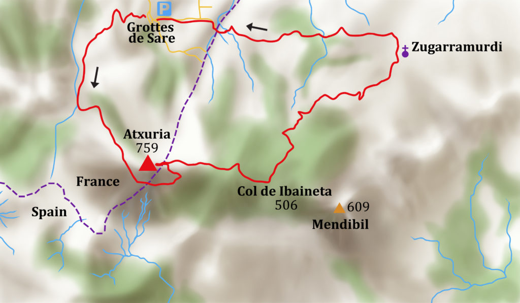
This route takes you over the rocky summit of Atxuria, down past prehistoric remains to Zugarramurdi, a village long associated with witchcraft. Return via ancient paths and among limestone caves once used by smugglers.
4 hours, 700m of ascent
ACCESS
Drive or take the bus to the Grottes de Sare
WALK
Grottes de Sare. Walk down the road from the cave entrance and after 50m turn left and through a gate on a path SW signed ‘Venta Loretxoa’ with green/pink marks.
10’ The path joins a stony track; turn left and uphill, stay left at a junction and just before a bergerie turn left on the track, which goes up through gorse SSE onto the flank of the mountain.
30’ join a dirt road and go up to the right. Stay right at a junction. Continue SW with the green/pink marks.
45’ Col Akoka, 456m, 0615462 – 4790728 Venta Loretxoa
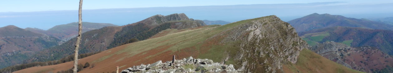
Go through a gap in the fence and turn left and E along the ridge and through mature beech trees with the cliffs of the summit ridge above you to the left.
1hr 5’ Shoulder of a ridge. Turn left following a yellow mark and climb up the grassy shoulder SSE on an indistinct path to the summit rocks. Walk with the rocks to your left until you come to a grassy gully marked by a cairn and a small tree. Climb the gully, and follow cairns to exit right near the top.
1 hr 35’ Atxuria, 758m 0616107 – 4790208 Descend NE along the summit ridge towards the village of Zugarramurdi, following yellow marks. After 10’ turn right at a large cairn, and then leave the yellow marks which go right and head SE down into the valley and towards the Col de Ibaineta.
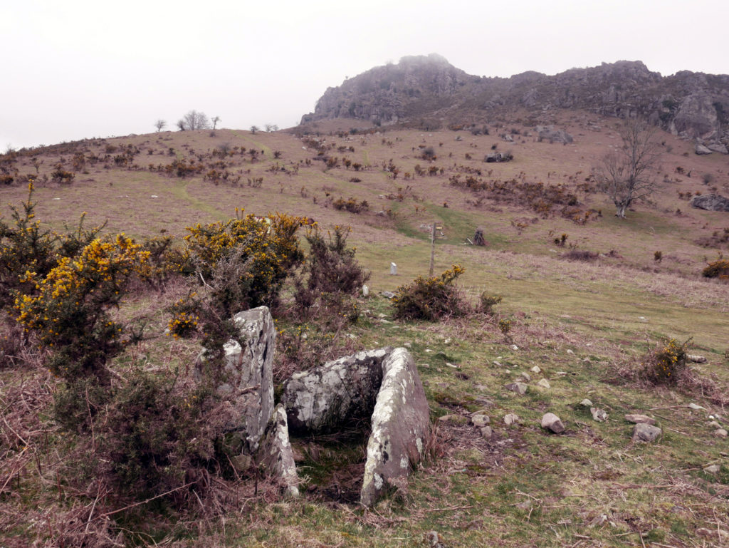
2hrs, Col de Ibaineta 514m, 0617239 – 4790147 stone circles and burial sites, signpost. Turn left and NE and descend through the forest following white/yellow marks. At a house, go down the road, and after 50m turn right on a track that crosses a stream. Continue steadily ENE through woods with fine views of the Rhune and the coast. The track widens and joins a river at a ruin. Cross the river and soon arrive at the village.
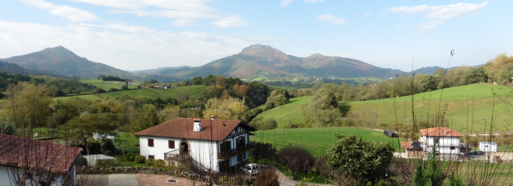
3hrs, Zugarramurdi village, restaurants.
Turn left at the church and follows signs to the caves. Walk past the witchcraft museum and the cave entrance. Then turn left following signs of a blue pony, which go back to the Grottes de Sare. Go down along the edge of a field, cross a river at a bridge and climb S. Join a road and turn right and NW.
3hrs, 40’ Information stones. Leave the road and descend past limestone caves. Turn left at a house, then right down a road and immediately left at a junction. Take the path to the left of a road back to the Grottes de Sare.
4hrs, Grottes de Sare
If you wish to walk to Zugarramurdi without climbing the Atxuria then from the Grottes de Sare walk up through the quarry car park and onto a paved path to the right of the road. Follow the symbols of the blue pony as far as the village, using the previous instructions in reverse.